Estate owners (1–104)
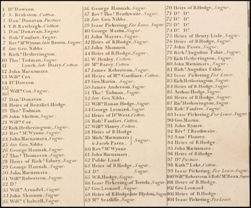
Click to enlarge
Temporarily shift, turn or resize the selected map to match the coastline you're looking at. This puts other areas out — press Snap back when done.
Maps of Tortola
An 1798 survey by George King and a 1959 D.O.S. map over the present-day island.
Use the bottom sliders to fade between the old maps and the present-day map.
Zoom with the slider on the right — drag it, or use the + and − buttons for fine, steady steps without pinching.
Use the Nudge map button to temporarily shift, turn or resize a map to match a stretch of coastline, then Snap back to the set fit.